A Hidden Gem Worth Every Step of the Lottery
Deep inside Zion National Park, away from the selfie sticks and shuttle lines, a geological wonder awaits those lucky enough to score a permit: the Subway.
Summary
There are two Zions. The first is the one most people see — Angels Landing, The Narrows, Emerald Pools — stunning, yes, but always crowded. The second Zion requires a bit more effort to access: a wilderness permit, an hour's drive on the Kolob Terrace Road, and a 9-mile round-trip hike along the crystal-clear waters of the Left Fork of North Creek. That second Zion ends at a geological marvel called the Subway — a smooth, tunnel-like rock formation carved over millennia by the raw power of rushing water — and it is absolutely worth it.
On May 12th, 2025, two friends and I set out from Zion Lodge before sunrise, drove through the quiet desert roads to the Left Fork Trailhead, and spent one of the most rewarding hiking days any of us can remember. This is our story — and everything you need to know to make yours happen.
The Trail
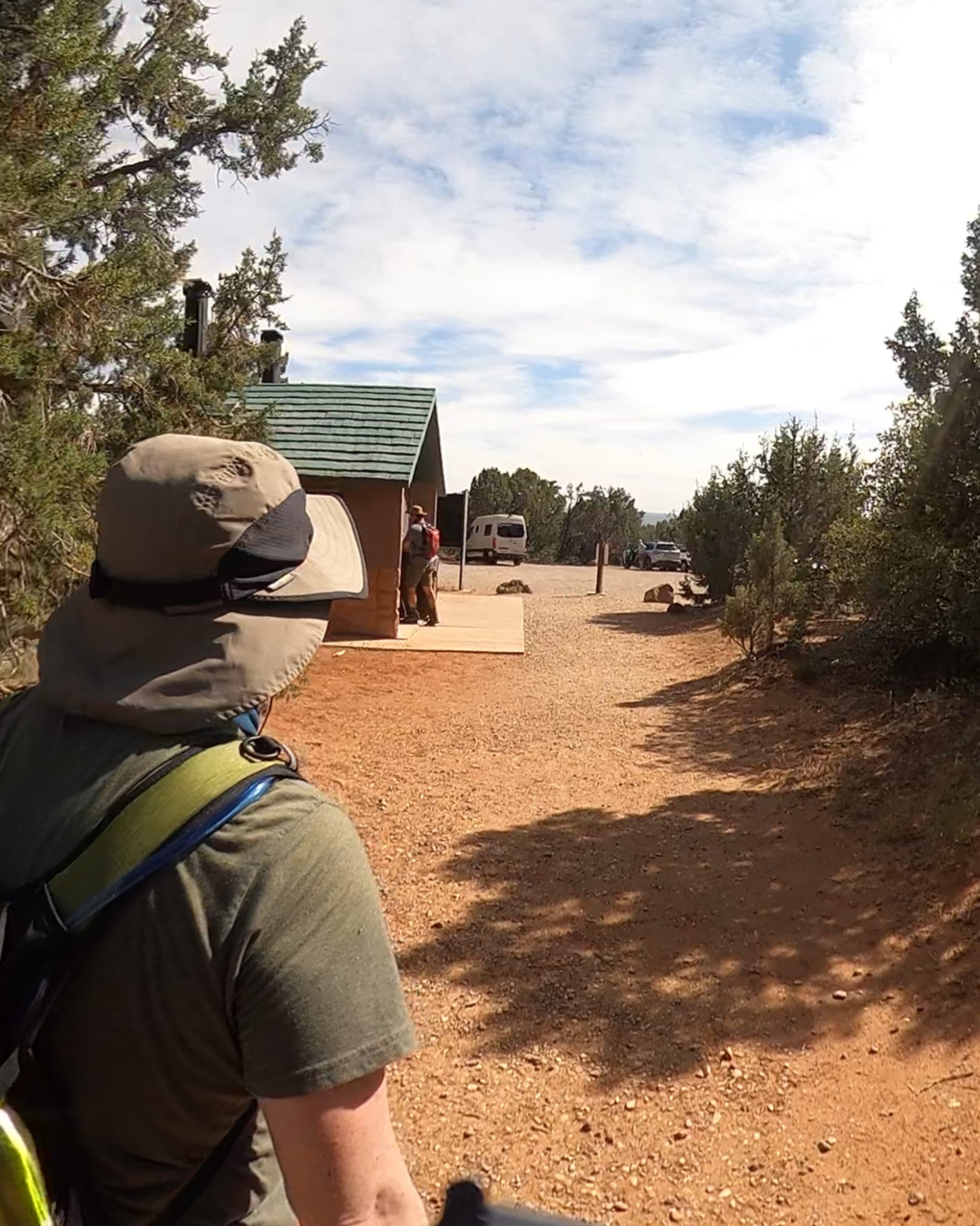
The Left Fork Trailhead sits on the Kolob Terrace Road, roughly one hour from the Zion Canyon Visitor Center. There are restrooms at the trailhead — use them. You won't find another bathroom until you're back.
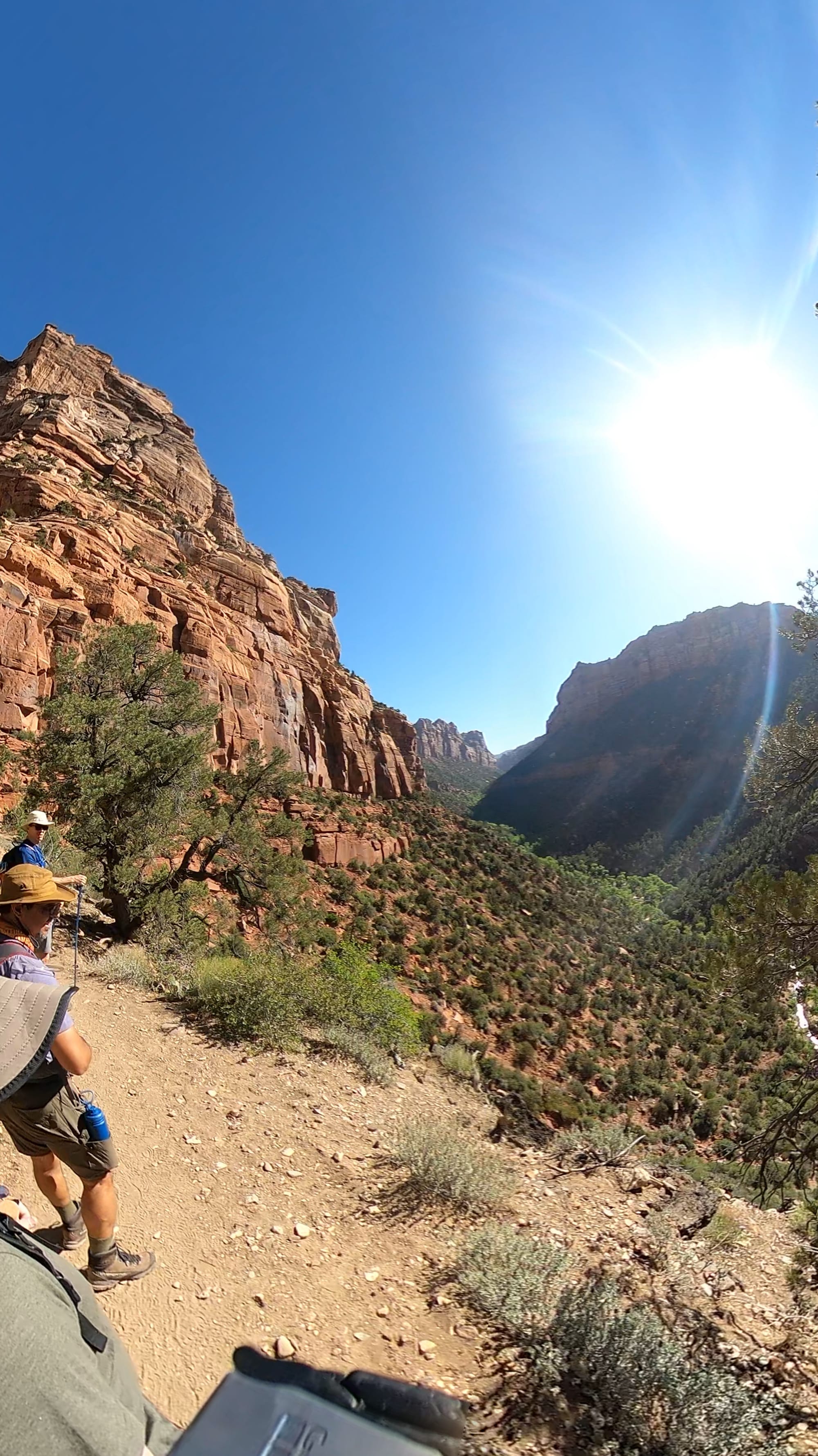
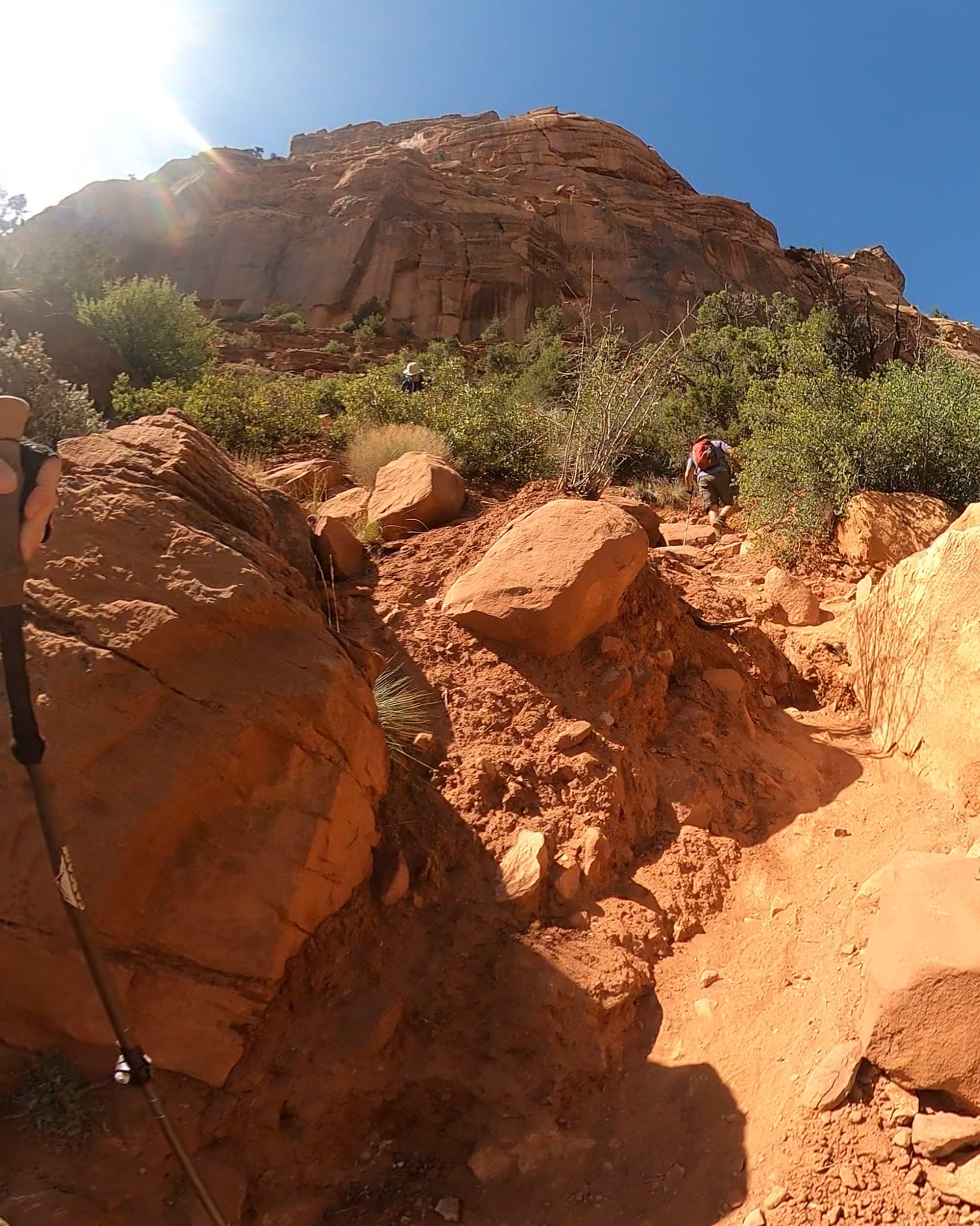
The first half mile of trail lures you into a false sense of ease: flat ground, desert shrubs, open sky. Then it drops. A steep, unmarked 400-foot descent over loose rock takes you down to the floor of the canyon. Take your time here. The footing is tricky in both directions, and the loose stones have a way of sliding out from under you when you least expect it. The reward, though, is a sweeping view of the valley that opens up as you descend — wide, wild, and surprisingly quiet.
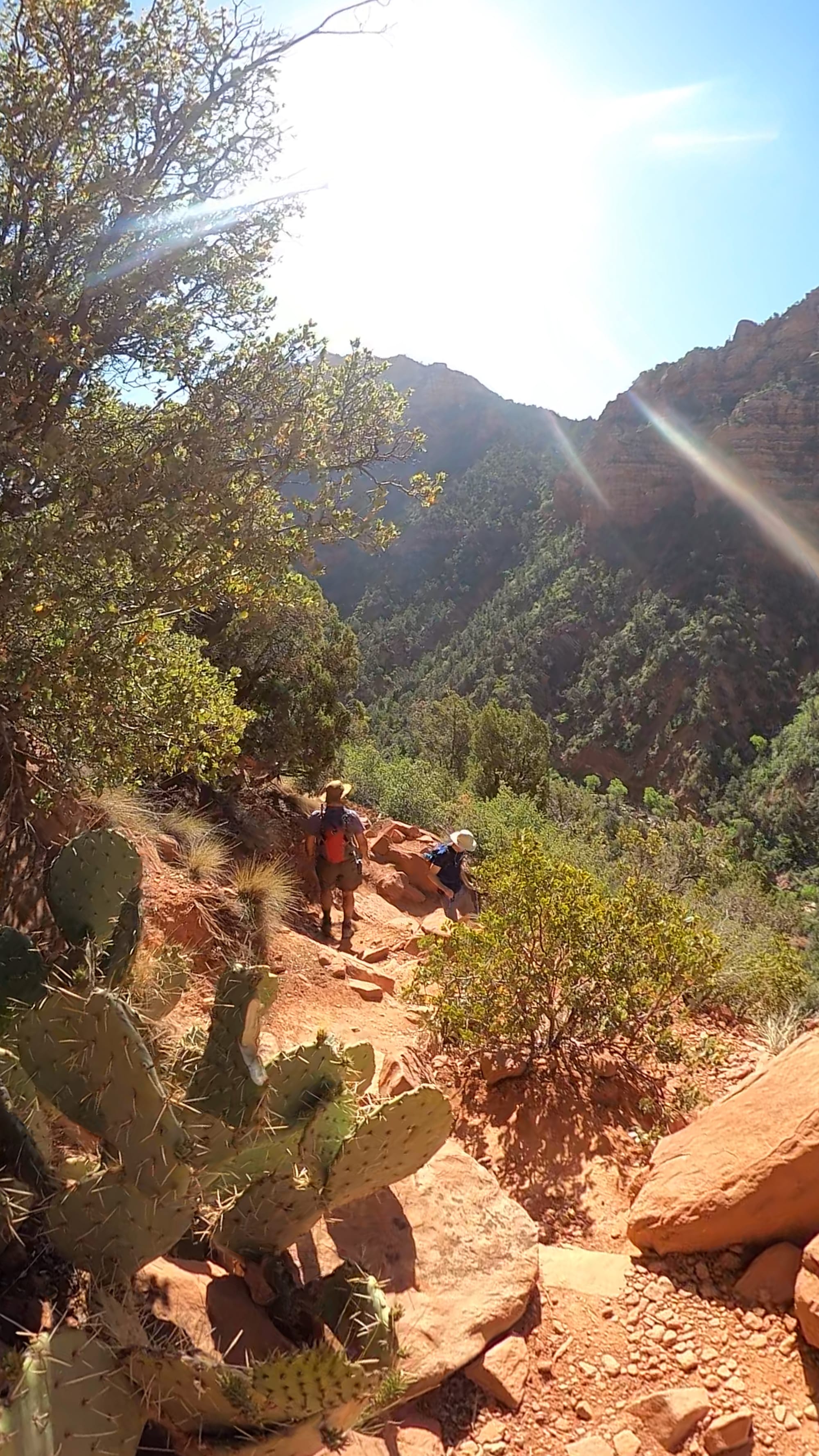
The descent into the canyon
At the bottom, the Left Fork of North Creek greets you with the kind of sound that makes city noise feel like a distant memory. Crystal-clear water, birdsong, and — on a weekday in May — a near-total absence of other hikers. Before you push on, take a moment to mark this exact spot on your phone or GPS. On the way back, there are no signs or markers to guide you back up the slope. It's easy to hike further downstream than you need to, and that extra half-mile at the end of the day is nobody's friend.
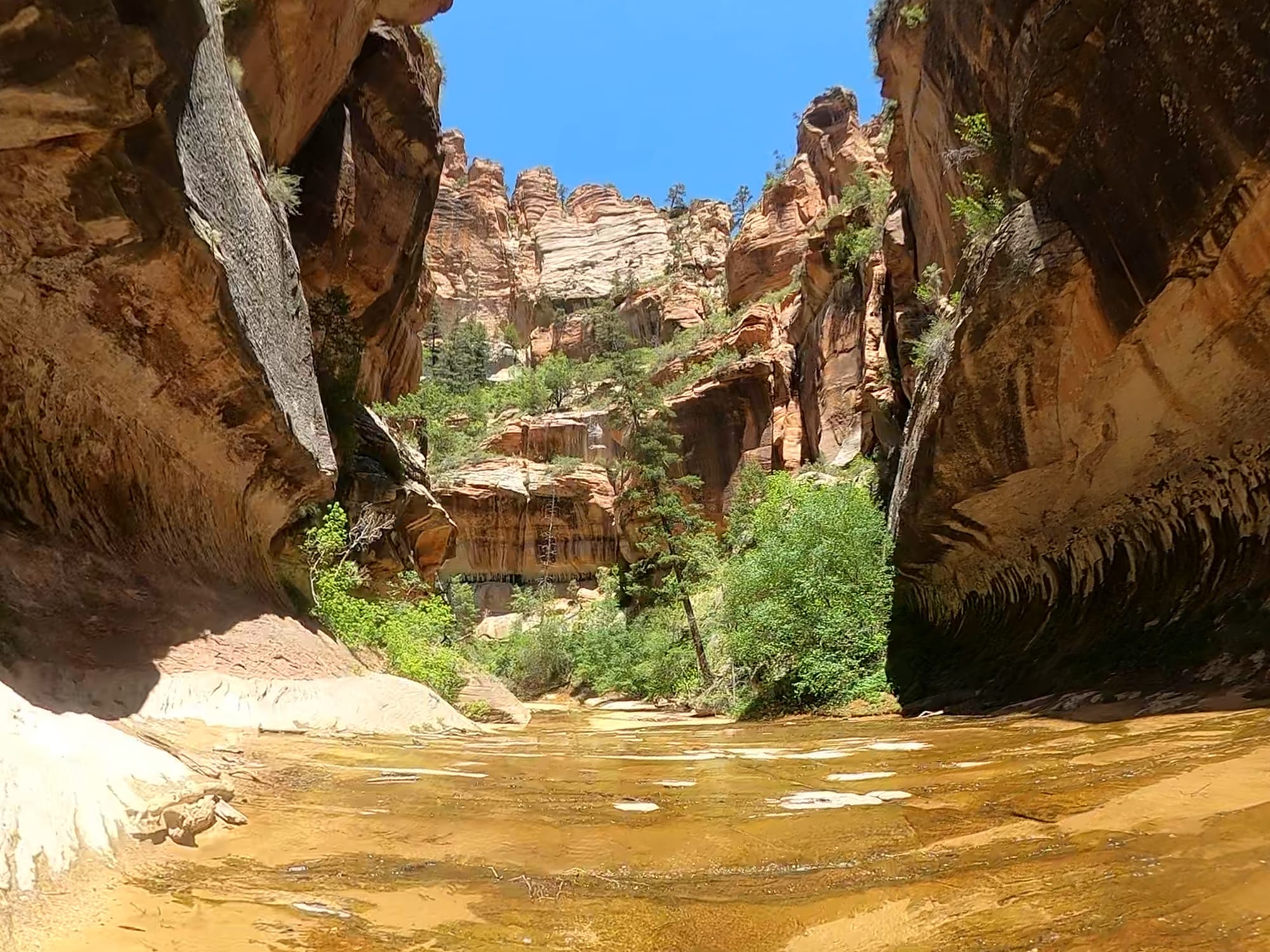
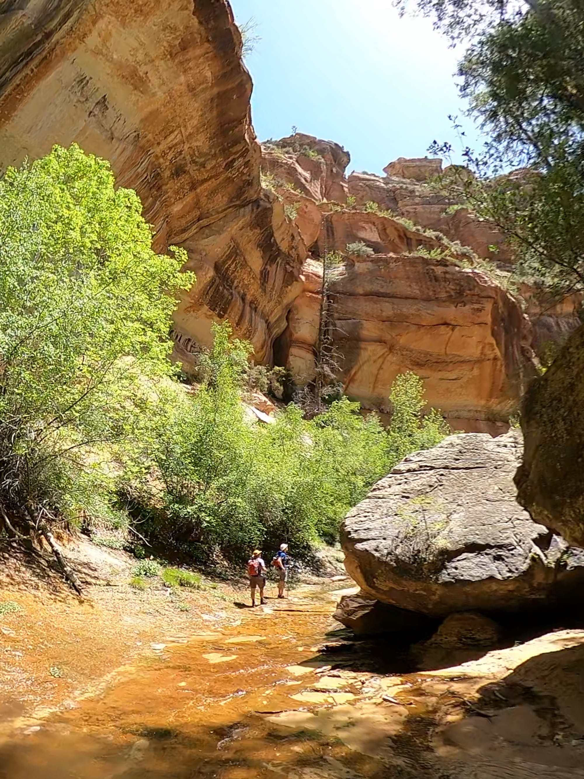
From the canyon floor, the trail zigzags across both banks of the creek for 4.5 miles until it reaches the Subway. The first few miles are dry-foot-friendly — careful rock-hopping keeps your boots clear of the water. But as the canyon walls begin to close in, the creek takes over more and more of the trail. In the narrower sections, it's often easier and safer to simply wade through the shallower stretches rather than fight for dry footing on the slippery banks. The water is cold and refreshing, the scenery otherworldly.
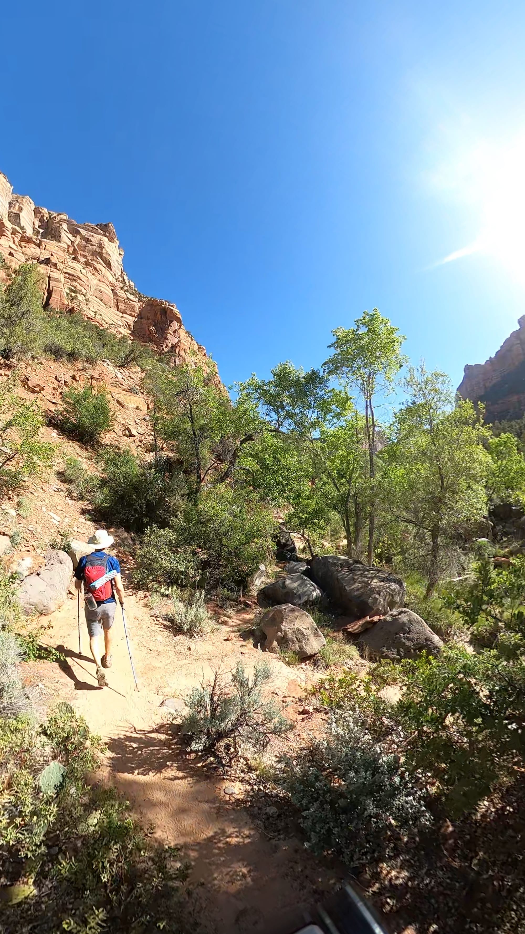
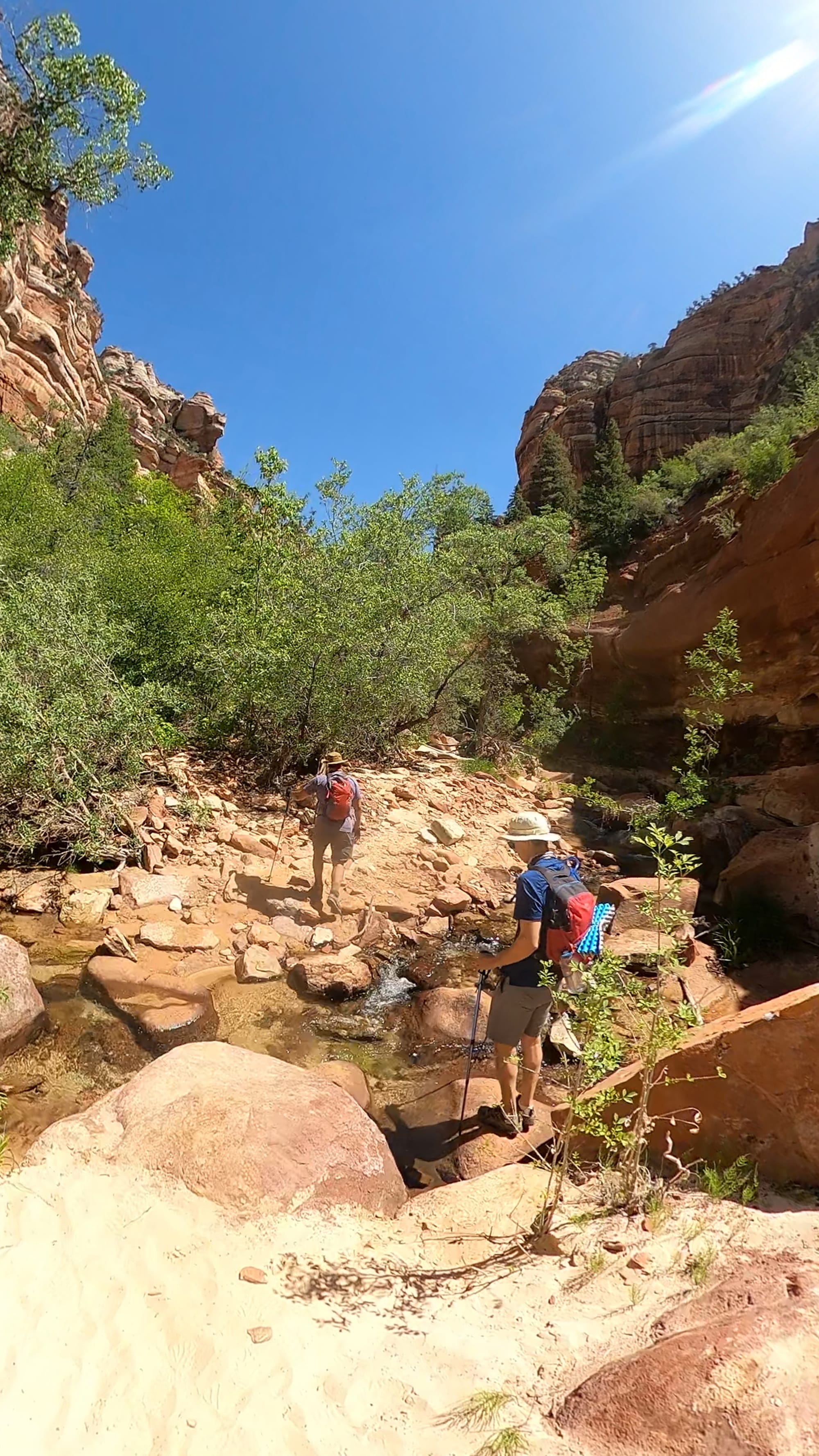
The trail along Left Fork of North Creek
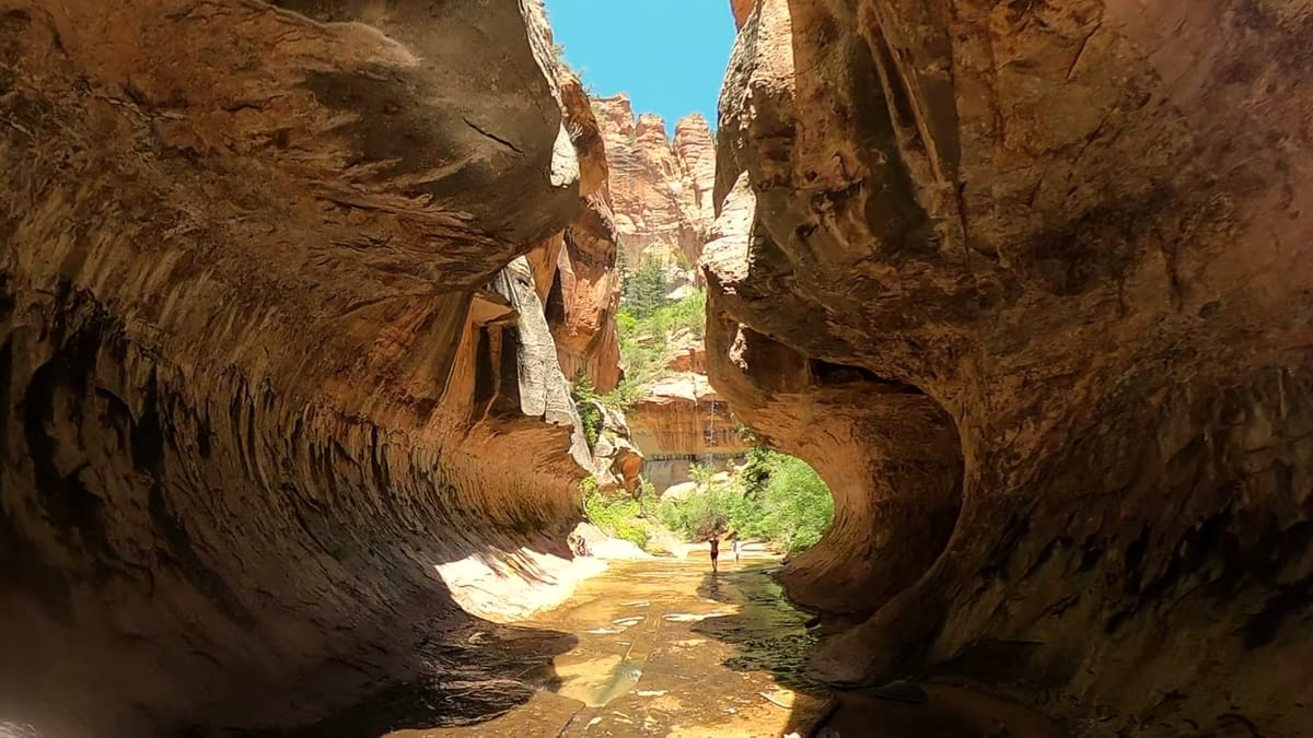
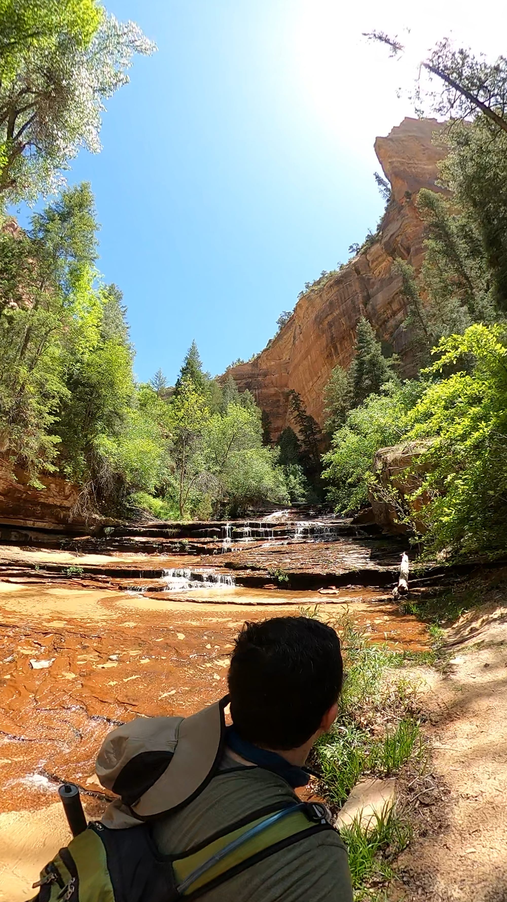
As you get deeper into the canyon, a question starts to form: is that it? The rock formations become increasingly dramatic, and you'll find yourself wondering if what you're seeing is the Subway. Don't second-guess yourself — just keep hiking. The real Subway announces itself. Walk until you physically cannot go further without technical climbing gear. That's where it is. That's where the trail ends.
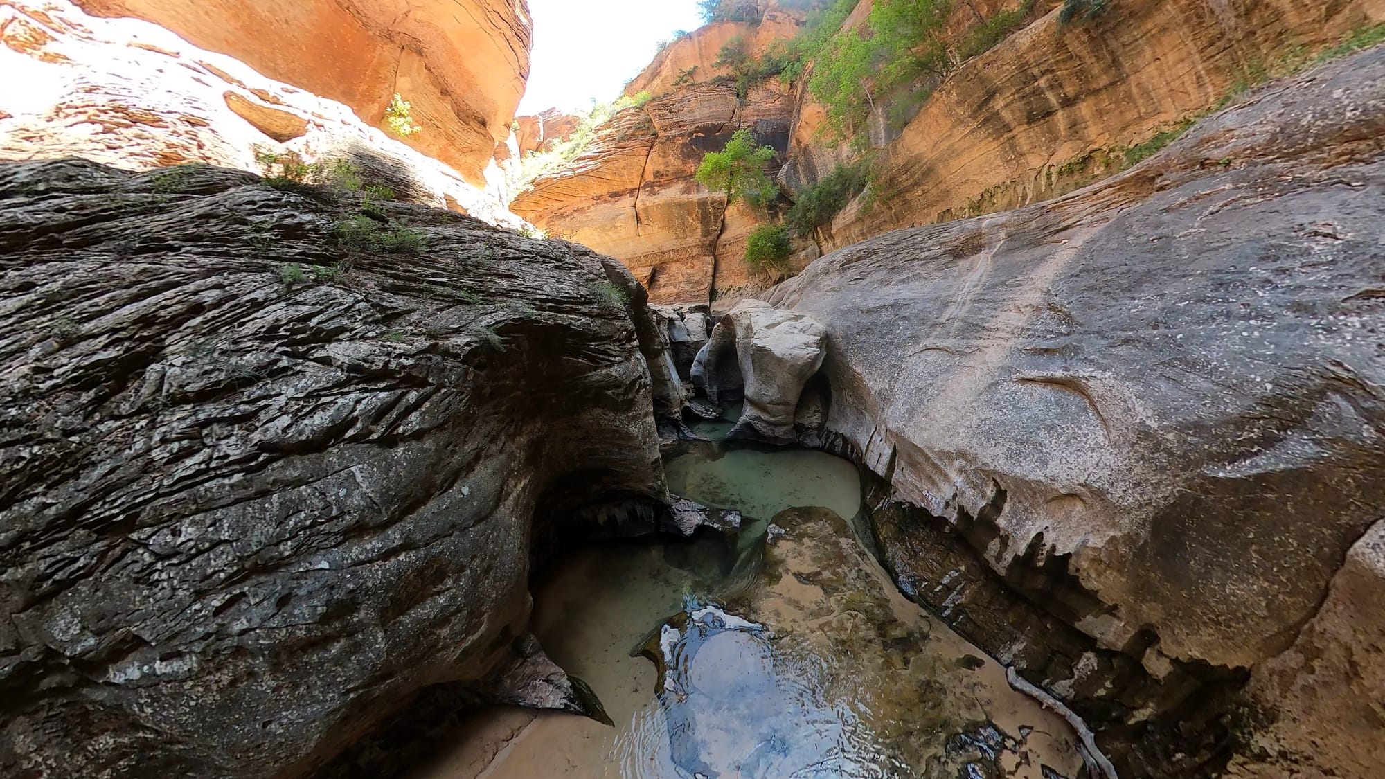
It took us four hours to reach the Subway at an easy, unhurried pace with several snack stops along the way. When we turned the last corner and the formation came into view, all three of us went silent. The Subway is a cathedral of sandstone — smooth, curving walls rising high above a tunnel-like passage carved by centuries of floodwater. Standing inside it, you understand something visceral about the power of water and time.
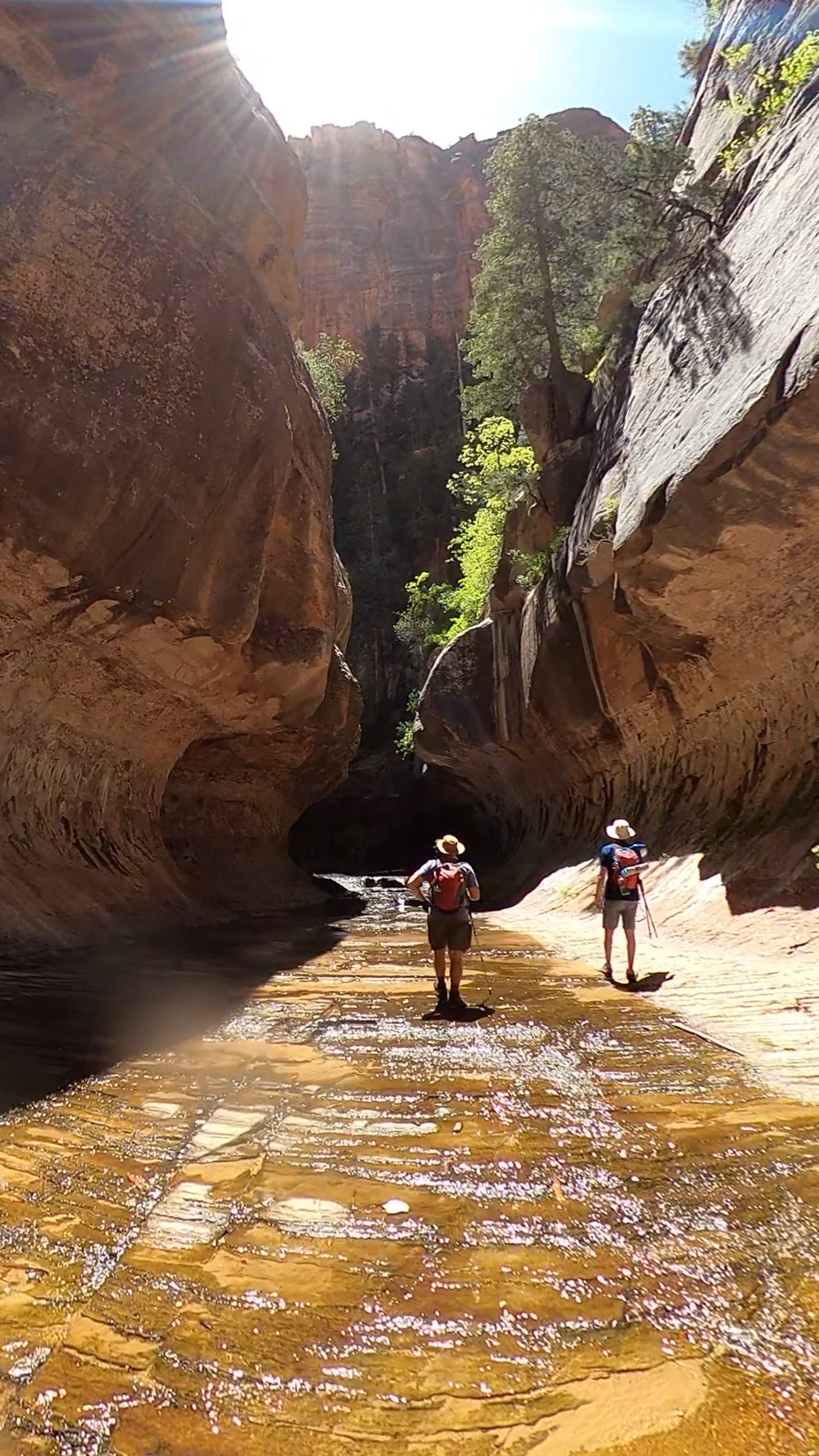
The entrance to the Subway
We had the entire formation to ourselves for about 30 minutes. Then another group arrived. Enjoy your solitude while it lasts — it's one of the trail's greatest gifts.
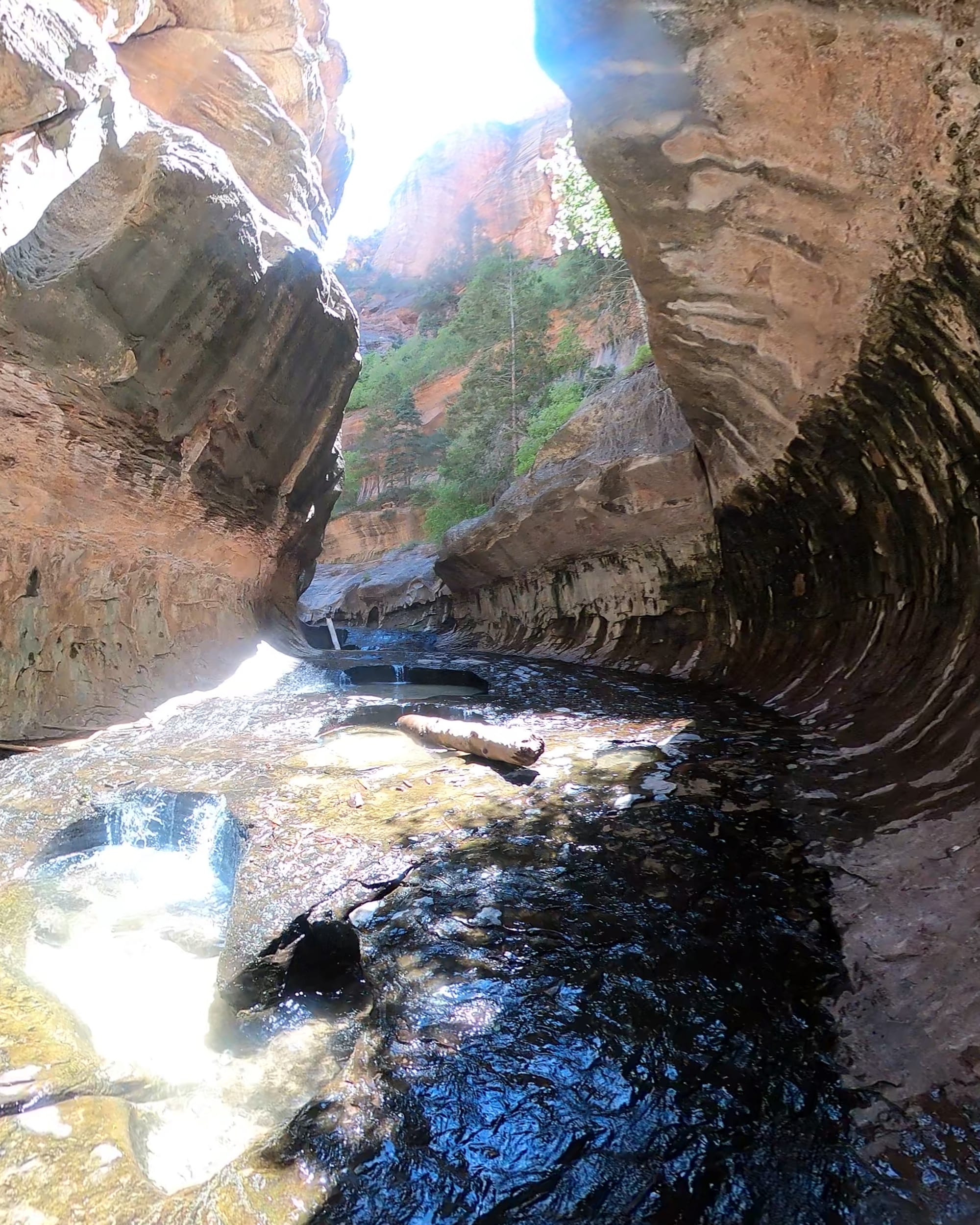
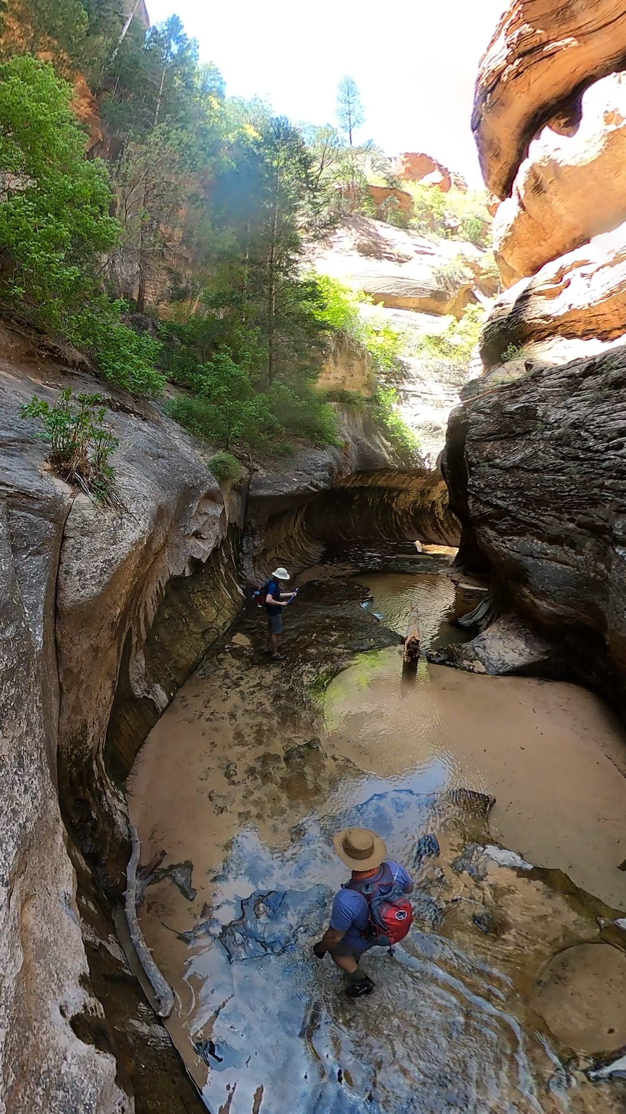
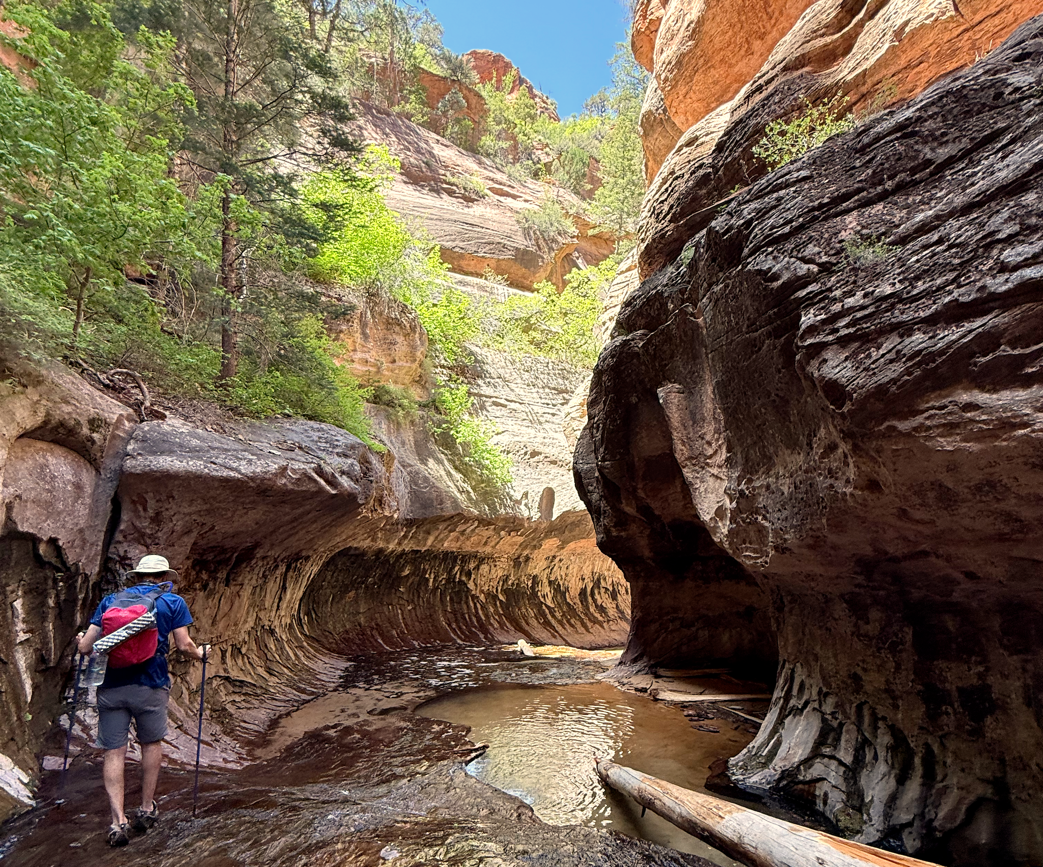
The Subway
After soaking it all in and letting our socks dry out against the warm rock, we reluctantly turned back. The return trip is gentler in most places, but that final 400-foot climb back out of the canyon is unforgiving. Take it slow, watch your footing on the loose rock, and stop to enjoy the valley view — the same one that greeted you on the way down now serves as a well-earned farewell.
Back at the trailhead, exhausted and still buzzing from the experience, the three of us agreed: this was a trail we'd do again without hesitation.
The hike out of the canyon
How to Get There
The Left Fork Trailhead is located on Kolob Terrace Road, approximately 8 miles north of Virgin, Utah. It is about a one-hour drive from the Zion Canyon Visitor Center.
A wilderness permit is required to hike this trail. The National Park Service runs a seasonal lottery for the Left Fork of North Creek (Subway) Bottom-Up route through recreation.gov. Applications typically open months in advance, so plan ahead. Full details on the lottery, preparation requirements, and trail conditions are available on the NPS Subway page.
- Trail: Left Fork of North Creek (The Subway) — Bottom-Up Route
- Distance: 9 miles round-trip
- Elevation: ~1,000 ft gain (400 ft steep descent/climb at the trailhead end)
- Difficulty: Moderate to Strenuous
- Permit: Required — seasonal lottery via recreation.gov
Tips
- Get the permit early. The lottery for popular dates fills up fast. Apply as early as the system allows and be flexible with your dates.
- Mark the canyon floor junction on your GPS. When you reach the bottom of the initial descent and the trail levels off at the creek, save the location. There are no signs, and on the way back it's easy to hike past this point.
- Prepare for wet feet. In the narrower sections of the canyon, creek crossings are unavoidable. Bring trekking poles for stability and quick-dry socks for the hike out.
- Don't stop early. The Subway formation is at the very end of the trail. Hike until you can't go any further without climbing equipment — that's your destination.
- Start early. A pre-dawn start from your lodging keeps you ahead of other permit groups and lets you enjoy the Subway in peace before others arrive.
- On the trail: Pack enough snacks and water than you think you need. The 9 miles and 1,000 feet of elevation change will work up a serious appetite and thirst. Energy bars, nuts, and a proper lunch to enjoy inside the Subway formation are highly recommended.
- Leave no trace. This is a protected wilderness area. Pack out everything you bring in.
For a more detailed view of my Zion Subway roundtrip hike in May, 2025, click on the GPS info or on the shared map of the hike below:
Happy Hiking!